
May saw a dry, settled, and warm end to the spring with high pressure influential throughout. Most areas were particularly dry, notably Scotland and western areas, with Wales and south-west England the sunniest regions. As we transition into meteorological summer, the warmth is forecast to continue, but with the help from both high and low pressure.
For June, we’re expecting a continuation of a weakened jet stream, so less changeability in the weather. A weak jet stream results in a lack of energy to build any significant frontal systems or to shift highs or lows along. This has been the case recently with a blocking high pressure system to the north-west of the British Isles driving settled, dry, and mostly sunny weather.
This blocking high will gradually shift away towards Scandinavia, allowing a weak area of low pressure to budge in from the south-west. With this, a southerly flow develops bringing in a much warmer and humid air mass.
This means hotter days but also less of an overnight drop in temperature. In combination with the humidity, the strong solar heating this time of year raises the chance for showery rain and potentially for thunderstorms to develop. England and southern areas are likely to be wetter than Scotland in this pattern, due to the incoming wind direction.
Low pressure, although weak, should remain in charge around north-west Europe for mid to late June. Though with a weak jet stream this doesn’t favour frontal rainfall, grey and cloudy conditions, but instead, sunny spells in between showers. As well, with the jet deflected further north, we should remain within warmer air masses from the continent.
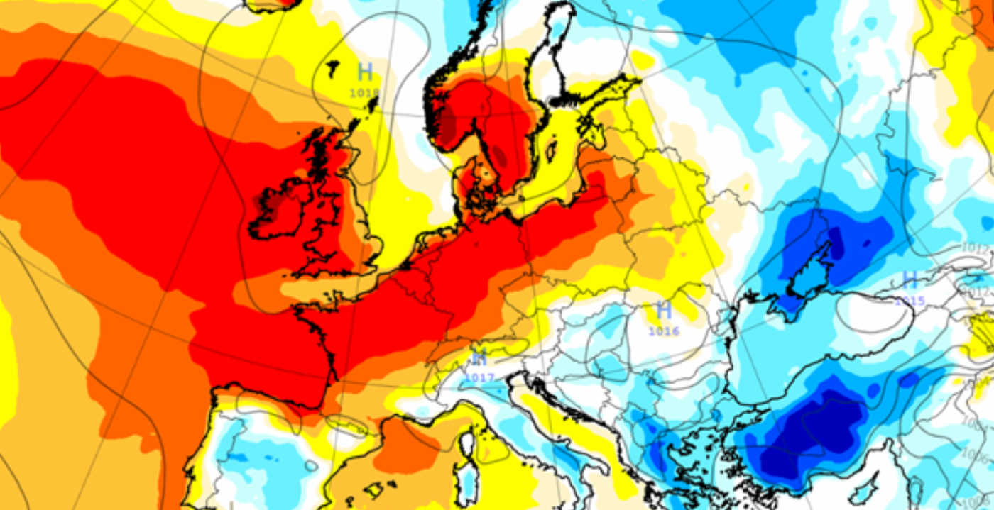
The long range temperature forecast from the European weather model, covering June, is shown in the map at the top of the page. The red and orange shading suggests temperatures will be widelymore than 2C above average across much of Northern Europe. This is thanks to a combination of the weak jet stream, high pressure blocking and some warm, muggy-feeling air pushing in from the south.
As we head on closer to July, the risk for blocking high pressure to return increases, which in summer means the potential for heatwaves. So overall there are some good signals for warm weather this June, but with some uncertainty surrounding drier or wetter weather as the month goes on. If we do see some rainy and cloudier days this will moderate the warming temperatures, but if a high pressure block does pan out, it will only help to further build up the heat.
About this author